
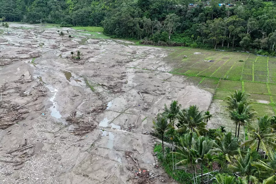
Natural disasters that struck several regions in Sumatra in December 2025 have left serious impacts on the agricultural sector. Damage to farmland, supporting infrastructure, and disruptions to production activities have become major challenges for farmers in various areas.
According to data from the Ministry of Agriculture as of 13 January 2026, the total area of rice fields affected by disasters in Aceh, North Sumatra, and West Sumatra reached 107,327 hectares. Of this total, 56,077 hectares suffered minor damage, 22,152 hectares moderate damage, and 29,095 hectares severe damage. In addition, crop failure affecting rice and corn reached 44,600 hectares.
The disasters also impacted plantation and horticultural sectors. Non-oil palm plantations, such as coffee, cocoa, and coconut, were affected across 29,310 hectares, while damaged horticultural land reached 1,803 hectares. Agricultural infrastructure was also impacted, including three damaged dams, 152 kilometers of irrigation networks, and 820 agricultural production roads.
As part of post-disaster agricultural recovery efforts, the Ministry of Agriculture has implemented a labor-intensive approach as its main strategy. This scheme involves farmers directly in rehabilitating their own farmland while providing them with daily wages during the recovery process. In Aceh alone, approximately 10,000 hectares of rice fields require rehabilitation, with an estimated labor demand of around 200,000 workers, allowing recovery efforts to proceed while helping sustain farmers’ livelihoods and strengthen food security in disaster-prone regions.

One of the agribusiness lecturers, Dr. drh. Zulmaneri, MM, also directly participated in distributing social assistance to several disaster-affected areas in West Sumatra, including Salayo Koto Lalang in Solok City and a number of locations in Solok Regency, such as Sanding Baka, Muaro Pingai, Malalo, and Batusangkar Sumpur. At the time of the visit, floodwaters were still visible in several areas, although water levels had previously receded and later rose again due to renewed rainfall.